Saturday morning’s sunrise shone bright and the weather app on our cellphones promised dramatically rising temps with no rain in sight. Perfect road trip weather. A Jeep with a full tank of gas remains our favorite muse.
After plotting our course, we double checked the “Little Yellow Yeep” for our usual supplies of water, snacks, trekking poles and emergency bug-out bags, which are permanently stored and restocked inside compartments that long ago replaced our rear seat, and off we went. We had a late start of about noon, but in our usual Desert Way fashion, typical for us.
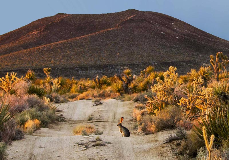
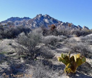
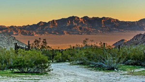
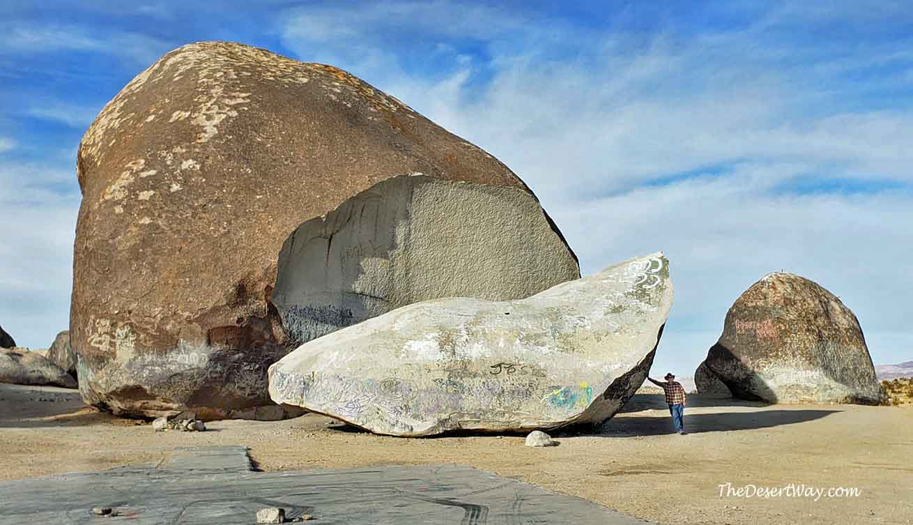
From Barstow, we took Interstate 40 to Kelbaker Road, north into the Mojave Preserve towards Kelso Depot. We then headed east, along Kelso-Cima Road towards Cima. As our elevation increased, we began noticing patches of snow in the shadows, and the gradual change of yucca’s and cacti to Joshua Trees.

An “E Vitus Clampus” historic marker on the left signals the turn-off onto the Mojave Trail at Cedar Springs Road.
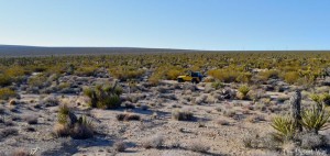
Our plan was to complete the 24-mile section of the old Mojave Road (AKA: Old Government Road), taking us to Marl Springs and beyond.
Here is our route, but there are other ways. Power Line Road is not recommended.
Originally, this path was an ancient Native American trade route that eventually led to the Pacific Ocean. In 1776, a Spanish Franciscan Friar, Francisco Garcés, traveled the same trail as he explored the desert on behalf of the Pope and the Spanish crown. By the time of the Civil War, the trail had evolved into what we now know as the Mojave Road.
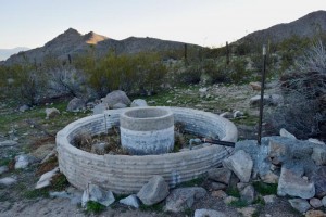
The path this road takes is no mere accident. It goes from one water source to the next, and was well known to the Paiutes and other native groups for centuries before the Europeans arrived. That fact explains the existence of Marl Spring.
It was a very important watering hole in a land that has few. This also explains why the U.S. Army established a small outpost here in 1867. The troops protected the water source for mail carriers going from the Arizona Territory capital in Prescott, to Drum Barracks near Long Beach.
Lieutenant Amiel Whipple’s 35th Parallel Expedition camped here on the night of March 7, 1854, and named this desert waterhole. They thought the white clay around the spring resembled marl, a soft calcareous material.
Marl Spring was a very important stopping point on the Mojave Road. It was a desolate stretch of 30 miles east of Soda Springs and 18 miles west of Government Holes.

Mojave Road historian Dennis Casebier speculates if Marl Spring had ever gone dry, even periodically, the absence of water here would have shut down the old Government Road, because 48 miles between watering places was simply too much for man and beast to survive.
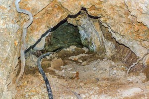
Fortunately, Marl Spring flows year round. Standing near the spring, you can still see and hear the stream of flowing water.

“On October 17, 1867, when the little stone outpost building with the associated corral was being completed at the upper spring, a band of desert Indians, estimated at 20 to 30, attacked the station.
This may be the only occasion on which the desert Indians attacked a fortified position along the Mojave Road in California. There were only three soldiers there at the time, and they took shelter in their partially completed outpost building.
In the best traditions of the romantic old west, early the next morning a column of more than 150 soldiers came over the hill and down into Marl Spring. The Indians melted into the rocks and disappeared.
The siege was lifted. There had been no casualties – only anxious moments. Marl Spring was never attacked again.”
Mojave Road Guide – Dennis Casebier

“Under one of these mesquite trees is the lonely grave of a young man, who came to the coast full of hope and ambition.”
~California Volunteer in the Army, 1863
“In On the Trail of a Spanish Pioneer,” Dr. Elliot Coues indicated that Father Garces followed a course that closely paralleled the Marl Spring-Government Road route. In the annual publication of the Historical Society of Southern California, 1927, and under the heading of “A Modern Interpretation of the Garces Route,” the late Dix Van Dyke stated that Dr. Coues was in error and that the Garces trail crossed the southern end of the Providence Mountains through Forshay Pass, then continued past the Devil’s Playground near Kelso to Soda Lake.
Van Dyke wrote that while the Marl Spring route was better for travelers with livestock and wagons, it possessed no advantages for bare-footed Indians who could easily out-travel horses. Van Dyke was not one to base his conclusions on easy-chair observations. He had covered practically every foot of the Garces’ trail westward from the Colorado River, walking when the trail became impassable for his specially built car, and comparing existing landmarks with those mentioned by Father Garces in his diary.”

During that magical twilight time between daylight and dusk, while sitting near the site of the headquarters building, I’m pretty sure I could hear a soldier on guard duty hollering from the rocks above…
“Wagon coming in!”

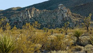
The road tops a low rise called the Cimacito Summit 13.6 miles from Kelbaker Road. A USGS benchmark here indicates the elevation is 4,556 feet, the highest point on the old Mojave Road.
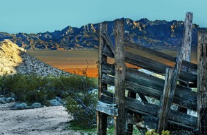
The broad valley to the east is drained by the upper Kelso Wash. To the northeast, you can see rounded Cima Dome. To the southeast, is the lofty Providence Mountains rising out of the desert floor.
Far in the distance to the southwest, you can see the sand dunes of the Devil’s Playground.

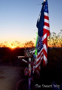
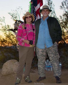
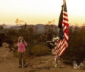
At the 11.6 mile-point from Kelbaker Road is the famous Mojave Mailbox landmark, placed here in 1983 by The Friends of the Mojave Road. Seeing it was like meeting an old friend, one of which until that moment, had only admired in others photos. There’s a register inside the mailbox and passer-by’s are encouraged to sign it.
We joyfully signed to mark this momentous occasion. It is interesting to read others comments and look at the stickers, cards and mementos. There is even extra water for those in need. Don’t forget to check out the whimsical frog collection near the monument and add your own.
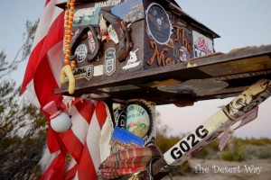


I volunteer with Water for Wildlife and a year or two ago we cemented the input water line into the trough. Nice to see the picture of it still in place. No vandalizing of the line. Thanks
We’re so glad to hear that, John. Let’s hope it stays that way forever! Thanks for your comments.
We hope it stays that way.