
Corn Spring is in the Chuckwalla Mountains of the Colorado Desert seventeen miles southeast of Desert Center. You can access the main dirt road with a high clearance 2-wheel drive vehicle. Native Americans relied on the springs, and they engraved many petroglyphs on the rocks in the area.

The Chemehuevi, Desert Cahuilla and Yuma bands frequented the spring and carved elaborate petroglyphs in the nearby rocks. Some of the oldest rock art is over 10,000 years old.

In the late 19th century, miners in the area also relied on the springs, and they established the Corn Springs Mining District in 1897.

The springs were added to the United States National Register of Historic Places in 1998.

Early pioneers found feral corn plants in the vicinity, giving the spring its present name.

Is its correct name Corn Springs or Corn Spring? The Bureau of Land Management calls it Corn Spring but Riverside County’s plaque embedded in a boulder at the petroglyphs site reads Corn Springs. Call it what you may, but we call it glorious.

The Chuckwalla Mountains are a mountain range in the transition zone between the Colorado Desert, Sonoran Desert and the Mojave Desert.
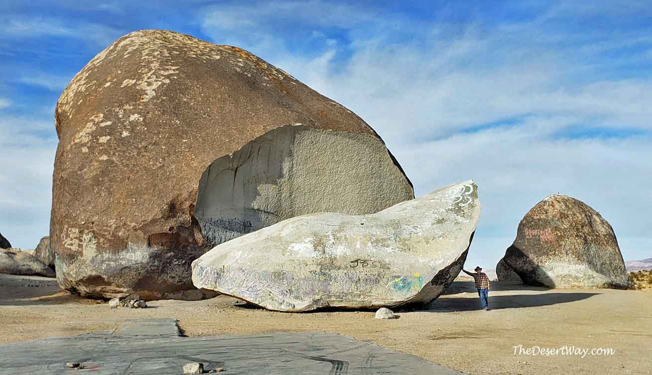
Many petroglyphs in the area indicate an earlier Indian presence and an ancient trail has been traced to the Mule Mountains near Blythe. You will also see recent glyphs of names, dates, and even an Indian head etched into the rock from early to mid-century in Corn Spring.

Here’s a nice email we recently received after publishing this article. “I enjoyed your story on Corn Springs. We had been there several years ago in fact February 2015. I was so afraid the place would be filled with snow bird people, that we rushed down there to find the campground completely empty. My wife and I always enjoy seeing the petroglyphs where ever we can and speculating about the person that made them. There are plenty to see in Corn Springs.
Anyways, I am a volunteer docent at the Mission Inn Hotel in Riverside. The symbol of the hotel and also the City of Riverside is called the Raincross. It was designed by the founder of the hotel, Frank Miller, and his architect, Arthur Benton with a California mission bell in a wooden frame and on top a double bar cross. We were always taught in our training classes that Miller was quick to point out that it was not a religious symbol, it represented a dragon fly, a symbol of the southwest natives for rain. Yes it totally resembles the Cross of Lorraine and crosses on the flags of several European nations (as well as a corporate symbol for Nabisco.)
So one of our instructors said he doubted the veracity of the story and thought Miller just made it up. Well, upon visiting Corn Springs I found one in the petroglyphs and realized the story was most likely true. That’s the story. Thank you for listening.
Sincerely, -Gordon Edwards” (09/17/20)
Many thanks to Gordon for contacting us and sharing this important information with us for all to enjoy.

Make sure you pack plenty of common sense along with lots of water no matter what the season. Sites are numbered by the BLM. Refer to their online guide for specifics. Prepare to be awed by ancient art and stunning scenery.

Meet Debbie, Lois and Judy, former residents of Corn Spring. We bumped into them near the petroglyphs and struck up a conversation. Turns out Debbie and Judy are Lois’ daughters re-visiting the area. All three shared fond memories of living in Corn Springs 40 years ago.
Best of all, they revealed Lois is 95 years young, which was also about the area’s temperature. What a delight talking with these three lovely ladies. Don’t let their pretty faces fool you though–they’re desert tough in all the right ways. To hear these knowledgeable ladies, please watch our YouTube video, embedded at the end of our story.

The Corn Spring Campground is available for $6.00 per dry campsite. There’s no hook-ups but limited water and a restroom is available on site. There was no one there when we visited in mid-June, except one horsefly from Hades who dive-bombed our every move.

California Fan Palms surround the spring. Typically there is no surface flow, but the wash that drains the area is named the Corn Springs Wash.
A man named Tyler Bennett stated that sometime around 1907 he planted two fig trees in the canyon, but others feel that the oasis has been there much longer. In 1921 there 57 trees, but a fire swept through later and damaged most of them. By 1945 there were over eighty.

The spring is dynamic, and for unknown reasons the amount of water coming to the surface has fluctuated widely over the years. The source of the water is unknown – very little rain falls in the area, and the nearest body of water is the Colorado River, over 40 miles to the east.

One mile past the campground is a miner’s cabin and the remains of one of the mills. More mines and cabins are located further up the road.

In the late 19th century, miners came to the area and used the water for processing their gold ore. They released burros which roamed the desert freely.

The most notable resident of the spring was Gus Lederer, the self-proclaimed “Mayor of Corn Springs.” Gus was born in Idaho in 1868. With only a couple of years of what we would call a formal education, Gus was admitted to the Colorado School of Mines. But he did not stay long enough to graduate.

Lederer lived at the spring until 1932, when he died from a black widow spider bite to the back of his neck. He couldn’t get to help in time and was subsequently buried at nearby Aztec Wells.

Although the miner’s cabin is vacant, it is apparent it gets frequent visitors. We have been told Gus never lived here.


There’s a couple of notebooks on a desk chock full of information, and in this case, even a curse.


It looks like somebody enjoyed some good meals over the years!


Three graves are located behind one of the miners cabins to the left at the dead-end road on a hillside. Bear left at the fork. Respect the privacy of cabin inhabitants if you go to the cemetery.


“Mayor of Corn Springs” August ‘Gus’ Lederer 1868-1932. Gus was known for serving his family of 18 burros a breakfast of flapjacks he made specially for them every morning.


The headstones were recently stolen. Thanks to the Clampers who replaced them and maintain the cemetery with respect and elbow grease.

You can return to the interstate at this point by re-tracing the way you came in. The BLM roads to your right, designated by a small sign, are full of sandy washes and rocky spots which criss-cross the road in multiple places but leads to beautiful scenery where regal Octotillo cacti rule.
A 4-wheel drive vehicle is highly recommended. When crossing washes, never come to a complete stop or stomp on the gas pedal. Either maneuver will likely guarantee you getting stuck. Slow and steady wins the race.

We came upon this old can dump deep in the desert near an abandoned mine. Although it may appear to be litter, it is actually a wealth of historical information and the closest most of us will ever come to finding treasure in the middle of nowhere. Remember, take only photos.


Thank you Jay and John,
What a marvelous sight! Never been near this part of the Desert. That’s the trouble with life: We only see a fraction and know so little about our world and our fascinating desert.
Thank you, Professor! We totally agree. Love all your books. We are humbled.
Great article. We were there a couple of months ago & saw the petroglyphs on the right just before the campground, sad to say they’ve been vandalized quite a bit. The cabin at the mill site a bit further past the campground was interesting & you have some good photos of the artifacts, etc that are there. We didn’t see the “curse” in the book but would love to know the story behind that! 🙂 Next visit we will go further up the canyon to the graves & other cabins. You mention a path to more petroglyphs, is that path near the ones by the side of the road?
The only way to remove a cholla barb painlessly is to either light the end sticking out with a lighter,(make sure not TO burn it too far down to grab hold of) This causes the hook, or barb to retract. The best way is to use a hot curling iron and touch it to the end of the barb for a few seconds. Barb will then easily slip out. One way Cholla reproduces by hooking into a moisture source and growing!
We used to camp at Corn Springs quite often in the early 70s. Usually our group were the only ones there. We would set up targets and shoot right out of the camp and explore in our 4 wheels. The petroglyphs were fascinating. But it seemed that in the late 70s when the place was “discovered” it went downhill with the groups that came in. One time a club of RVs and dirt bikes came in and camped. They were rude, riding their bikes right through our campsite. Created a lot of tension to say the least. Another time my brother and husband were lost and found a cabin. They stopped to ask directions and an old man chased them off with a shotgun. They did find their way vback and said there was a cabin made of glass bottles but because they were so lost they never could figure out how to find it again. I would really have loved to see it.
Thank you for this very informative site. Been to the campground and surrounds. Curious about the cabin near the cemetery – is it occupied? Also, I know one can drive 15-30 miles for rockhounding but is there anything of interest in Corn Springs valley?
Down the road off of Goff’s Rd. We are here right now and we are collecting blue chalcedony!!!
That’s awesome, Denay! Good luck!
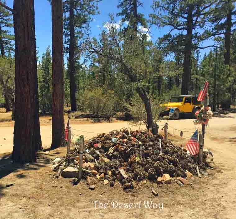
Looks like there’s a whisp of smoke coming off the top of that little mountain in the next to last picture. Must be someone camping. Thank you for another thoroughly enjoyed tour through the desert.
Hi Aaron! The whisp is more than likely a dust devil. It was very windy last time we visited. Thank you for your comment!